Once upon a time, a beautiful stream meandered through a rich bottomland forest on its way to a great river. Unfortunately for the stream, its destiny would be decided by a city that began on the river and slowly spread its tentacles across the floodplain. Eventually the stream succumbed to the needs of the growing city, and its degraded waters were locked for good into an unwavering channel. A familiar story – the common fate of all urban streams, including our own South Fork of Beargrass Creek.
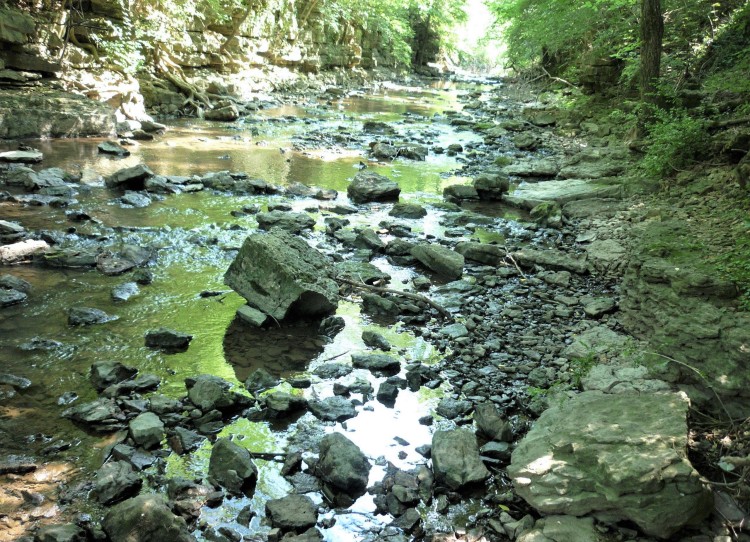
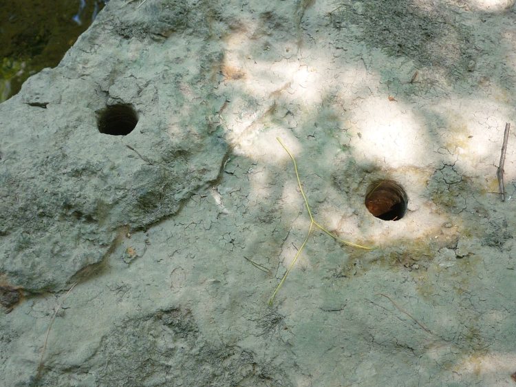
Compared to the beautiful unchannelized sections of the Middle Fork (think Big Rock in Cherokee Park) the South Fork would be more accurately described as the “ugly”, “forgotten” or “ruined” fork. But just how did this come to be? How (and why) is an entire stream drainage placed into a deep ditch? The round holes in this creekbed chunk of limestone are a clue; eighty-five years ago they contained explosive charges. Amazingly, the rocky gorge in the opening photo is manmade, blasted through a section of local geology called the Louisville Limestone.
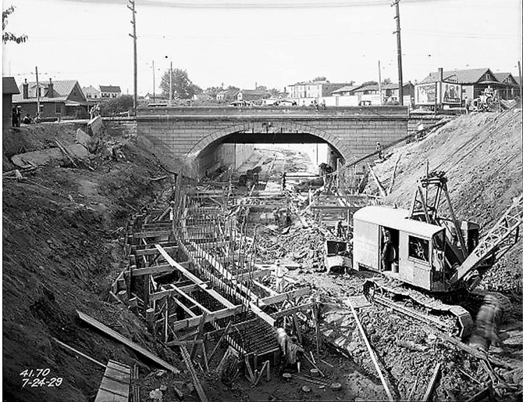
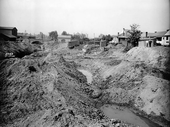
Elsewhere on the South Fork the channel was carved out by steam shovels and/or early diesel diggers starting in 1926. (historic images: U of L Photographic Archives)
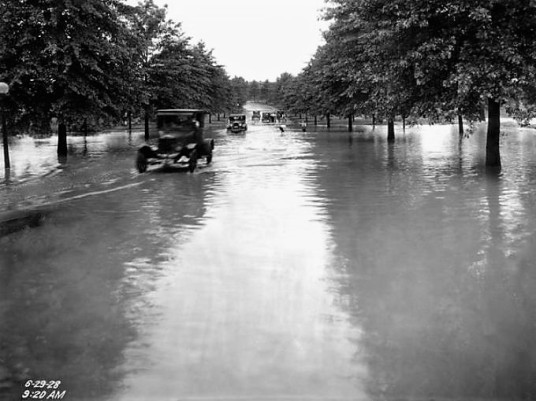
Of course channelization happened for a reason – if you were a resident of a neighborhood near the creek in the 1920’s, you could expect flooding during periods of heavy rainfall. The flooding was likely exacerbated by the rapid development of urban Louisville; images from this time portray lots of bare earth and few trees.
Channelization was the solution to this urban woe, and it effectively locked away a troublesome stream that had become little more than an open sewer.
By the end of the 1930’s, the South Fork below Eastern parkway was fully encased in a concrete channel, the upstream stretch in a deep ditch.
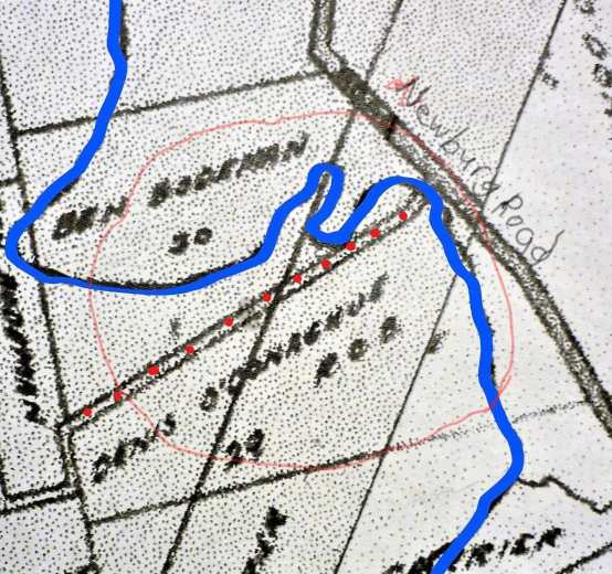
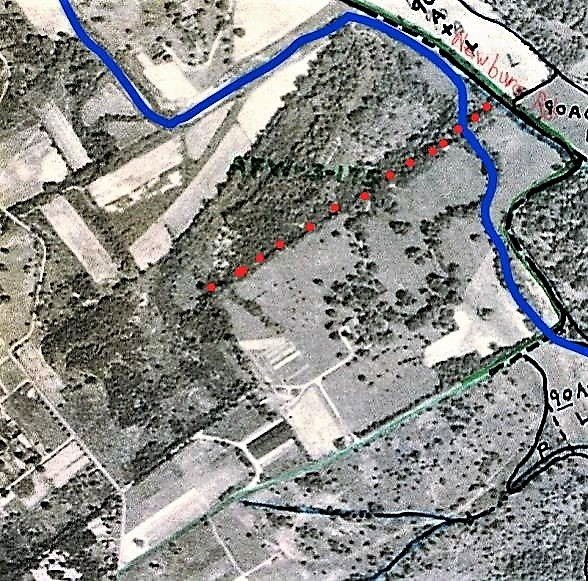
So with this background, lets return to the section of creek that Beargrass Creek State Nature Preserve is named for. The portion of a 1913 map (below) shows what is now the northern part of the preserve bordering Newburg Road. The red dotted path, once referred to as “Prather Road”, is now the long bottomland portion of the White Oak Trail. Beargrass Creek, traced in blue, meanders over the floodplain and is not confined to a permanent channel. (By the time a stream reaches the floodplain of a river, sinuous meanders are the rule, due to the action of erosion and deposition.) Over the eons, the South Fork’s meander has shifted during periods of flooding.
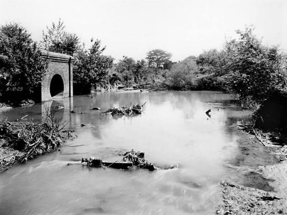
Contrasting the old map with the post-channelization pic below, we see that nice straight lines have replaced the meanders, making it convenient for landowners to grow crops on the “floodplain” with low risk of flooding.
But what are the consequences of this so called improvement? The channelized creek is narrow and deep, and when swollen with flood waters it rages along at high speed, making it hard for stream life to hang on.

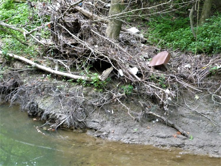
Evidence of bank scouring during high water flows (pic below). The formation of a riparian zone is thwarted by the steeply eroding sides of the channel as well as the periodic high velocity flow. Deposition sites, such as the debris wrapped around this tree, are often chock full of exotic plant seeds like Porcelainberry
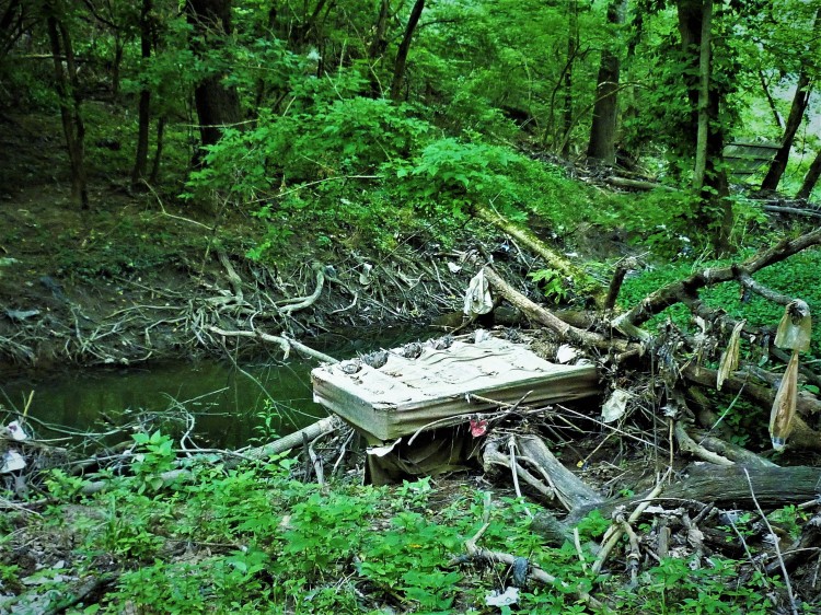
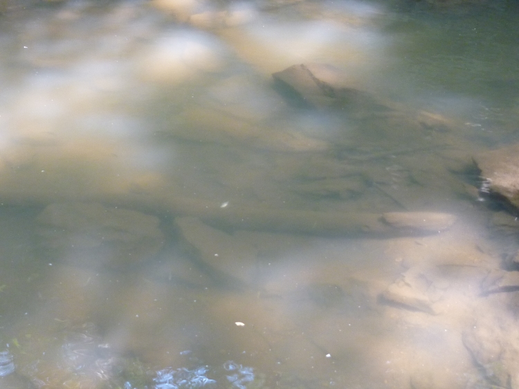
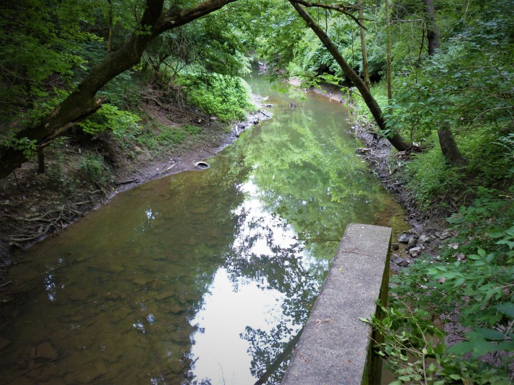
At low water, numerous embedded tires are visible in this section below the Audubon Ridge subdivision.

The murky waters of the South Fork have a noticeably rank odor, in part because of CSO’s and SSO’s – short for Combined Sewer Overflows and Sanitary Sewer Overflows.
These MSD solutions to sewage disposal operate just as their names imply; by allowing overflows of sewage into urban streams during heavy rain events, when the system can’t handle the volume of water flowing into it. The old CSO’s were designed to permit this sewage scenario, SSO’s try to prevent it but don’t always succeed. The link below is a map of local CSO and SSO locations.
https://apps.lojic.org/msdcsossolocations/
MSD is in the process of building a number of huge retention basins in our urban area, to address sewage overflows in response to a Federal Consent Decree from the EPA. See link below for everything you always wanted to know about sewer overflows and MSD’s project WIN (Waterway Improvements Now).
http://msdprojectwin.org/About-Us/Louisvilles-Sewer-Overflows.aspx
The Nightingale retention basin project (pic below) is on the South Fork adjacent to BCSNP, and is nearing completion. It’s located at the end of Nightingale lane, off Poplar Level Road. The distant building in the upper left is Our Lady of Peace hospital on Newburg Road.
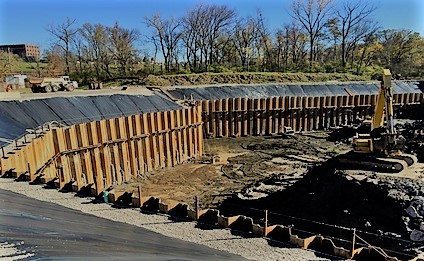
Though 6 acres of wildlife habitat were destroyed to prepare the site, (including 14 box turtles permanently displaced and the rest deceased), it is hoped that preventing sewage overflows into the creek and the river will be good karmic compensation.
And, despite sewer overflows, life goes for many animals – the chewed-off bark on this limb indicate it’s the leftovers of a beaver’s meal. Several turtle species inhabit the creek, including Red-eared Slider, Painted, Spiny Softshell, and Snapping turtles.
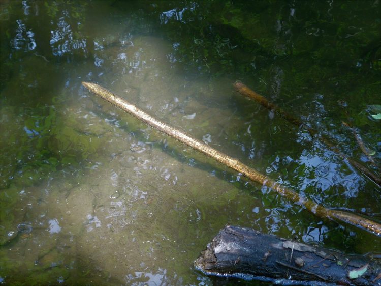
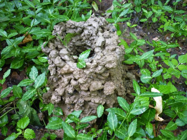
Crayfish chimneys are common along the banks of the South Fork and the smaller steams that feed into it. Can’t tell you the name of the species that made this one, as there are many in our region and I’m not a crayfish expert.
However, it’s interesting to note that we have a rare species of crayfish found only in the Salt Creek watershed (which includes Beargrass Creek) and a handful of Indiana sites. It’s the Louisville crayfish, Oronectes jeffersoni, which lives in shallow riffles under rocks. Likely habitat could be found in the man-made limestone ravine shown in this post’s opening pic. Admittedly this site is unique for the South Fork, and gets my vote for the most scenic locale along the channelized stretch, (that is if you don’t count the graffiti in my 4/27 post “Trash and Strange Beauty”.)

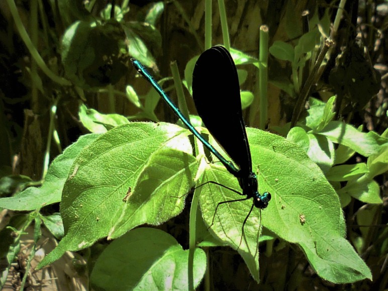
Emerald Jewelwing dragonfly near the site where a spring-fed stream feeds into the South Fork below the Earth and Spirit Center.
Is there any remnant of the former channel of the South Fork before channelization? Some of us who work in the forest at BCSNP have wondered that too, and we’re pretty sure we’ve found it. Winding through the bottomlands of the preserve is the trace of an old channel that matches the old map, just a wide slough lined with tall Sycamore, Cottonwood, and dying Ash trees. The old channel holds water seasonally, but no longer connects to the deep ditch that is the new channel.
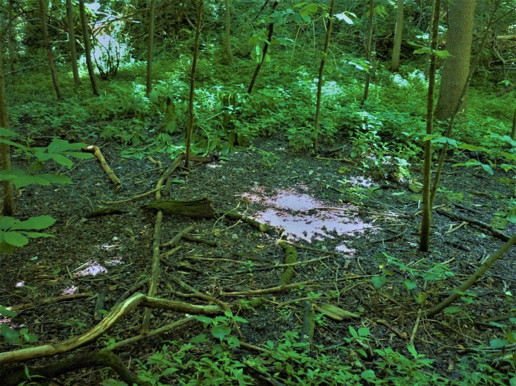
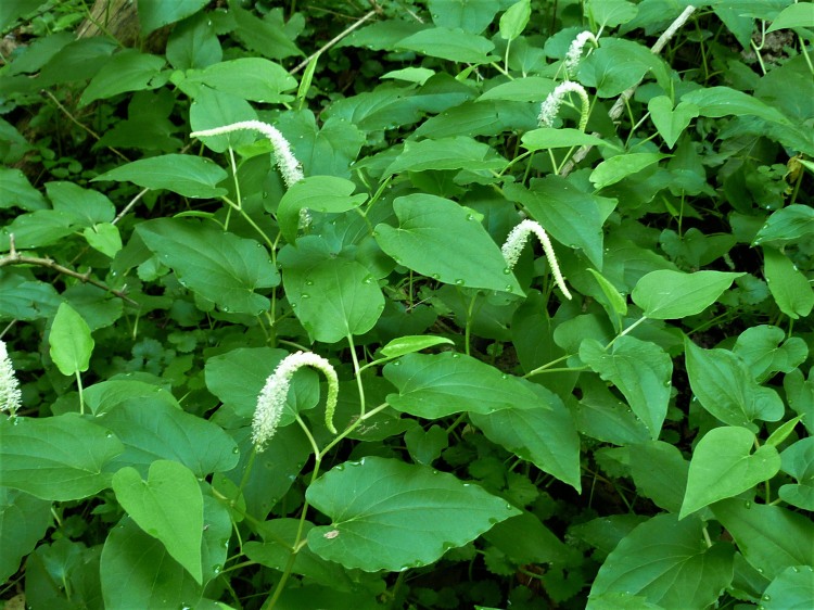
In one portion of the old channel, there remains a small population of the wetland and excellent pollinator plant Lizard’s Tail ( blooming profusely in this pic from early summer).
Hopefully this short tour of a small section of the South Fork has been enlightening. It’s the kind of nature-inside-Louisville story that I love to write. We can all wish and dream for better things in the future for this neglected fork of Beargrass Creek. And maybe someday we’ll even make it happen.

Cam
Very informative with great narrative and supporting data links! Thanks
LikeLike
Marianna metcalf
Oh gosh, I think I used your email instead of using this entry box.
Well it was totally positive.
Thank you
M.
LikeLike
conrad selle
I used to get reports on the Louisville Water Companies water. Do you know where I can find analysis of the water that is running through the channelized creek and analysis of Middle Fork water (which is not that wonderful either) and other rivers and creeks of the region?
Probably the Nature Preserve is better off now that the creek no longer runs through but around it. Just the volume of litter would turn the whole place nasty.Once this spring I tried to pick the litter out of the 300 foot rock channel so a decent photo could be taken without garbage. Now it is just like it was before.
LikeLike
Greg Sheehan
Very interesting. It gives great perspective on the affect cities have on nature. We should be more attentive to the development of cities.
LikeLike
Ann Rosa
Wow! I didn’t know the background of the this area. Thanks for all the research and information. I hope that future plans for this area will take into consideration all that has been done and needs to be corrected.
Keep up the good work.
LikeLike
wardatkwa
Nice article. I need to explore there some more. Thanks.
LikeLike
oneforestfragment
Thanks for all the great comments! There is a new group, the “Beargrass Creek Landowners Consortium” that meets monthly at the Earth and Spirit Center. If you care about the future of the South Fork, and want to attend the meetings, please contact kyle@earthandspiritcenter.org.
LikeLike
Kenny Popp
Great info, Rosemary, It gives a better prospective on litter, as I am sure if you could trace the litter it would go all the way to the creeks source. KP
LikeLike
oneforestfragment
Good point Kenny!
Every storm sewer grate lining neighborhood streets and parking lots in the Beargrass Creek watershed feeds plastic bottles, shopping bags, etc into the creek whenever we get a heavy rain, not to mention pollutants such as motor oil, lawn chemicals etc. That’s why MSD is promoting the downspout disconnection program. Thanks, RB
LikeLike
Anonymous
Great article! Once the Nightingale MSD project is complete, I will be happy to adopt some of the box turtles, as we discussed. I look forward to having box turtles in our habitat again. I miss the two box turtles that visited with us each year, prior to the Nightingale MSD project .
LikeLike
oneforestfragment
That sounds good. When will the project be finished? Will there be anything planted other than grass? RB
LikeLike